Map 12713: VHF Reception on Macquarie Island
Map details
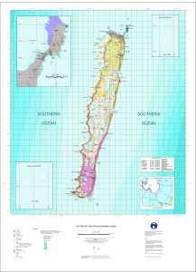
| Map Number | 12713 |
| Title | VHF Reception on Macquarie Island |
| Edition | 1 |
| Scale | 1 : 50 000 |
| Publication date | June 2001 |
| Publisher |
Australian Antarctic Division (Australia)
|
| Spatial coverage |
(158.5830° -54.3500°)
,
(159.1160° -54.3500°)
,
(159.1160° -55.1250°)
(158.5830° -55.1250°) |
| Projection | Universal Transverse Mercator |
| Physical size | 100 x 73 cm |
| Notes | The VHF reception information shown on this map is no longer current. |
| Keywords | Topographic |
Downloads
This is a digital map available for downloading.
Map Lists
No maps lists available.
Additional Information
| Horizontal datum | WGS84 |
| Vertical datum | Mean sea level |
| Magnetic variation | Magnetic north is 31 degrees east of true north in 2001 |
| Nomenclature | Nomenclature Board of Tasmania |
Preview