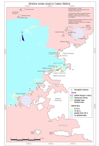
Map 12830: Shallow areas close to Casey Station
Map details
| Map Number | 12830 |
| Title | Shallow areas close to Casey Station |
| Edition | 1 |
| Scale | 1 : 85 000 |
| Publication date | April 2001 |
| Publisher |
Australian Antarctic Division (Australia)
|
| Spatial coverage |
(110.3333° -66.1667°)
,
(110.6667° -66.1667°)
,
(110.6667° -66.4167°)
(110.3333° -66.4167°) |
| Projection | Universal Transverse Mercator |
| Physical size | - |
| Notes | Prepared for "Casey Station Oil Spill Response Contingency Plans" |
| Keywords | Shallow , Casey , Windmill , Bathymetry , Bathymetry |
Downloads
This is a digital map available for downloading.
Map Lists
No maps lists available.
Additional Information
| Horizontal datum | WGS84 |
| Vertical datum | Lowest astronomical tide |
| Nomenclature | Australian Antarctic Gazetteer |
Preview