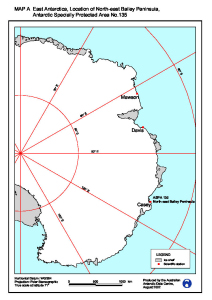
Map 12935: East Antarctica, Location of North-east Bailey Peninsula, Antarctic Specially Protected Area No. 135
Map details
| Map Number | 12935 |
| Title | East Antarctica, Location of North-east Bailey Peninsula, Antarctic Specially Protected Area No. 135 |
| Edition | 1 |
| Scale | 1 : 19 000 000 |
| Publication date | August 2002 |
| Publisher |
Australian Antarctic Division (Australia)
|
| Spatial coverage |
(-180.0000° -60.0000°)
,
(180.0000° -60.0000°)
,
(180.0000° -90.0000°)
(-180.0000° -90.0000°) |
| Projection | Polar Stereographic |
| Physical size | 27 x 19.2 cm |
| Notes | Map A prepared for a Draft Management Plan for the North-east Bailey Peninsula |
| Keywords | ASPA 135 , North-East Bailey Peninsula , Protected Areas |
Downloads
This is a digital map available for downloading.
Map Lists
No maps lists available.
Additional Information
| Horizontal datum | WGS84 |
| Vertical datum | Mean Sea Level |
| Nomenclature | Australian Antarctic Names Gazetteer |
Preview