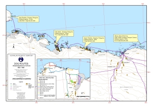
Map 12976: Dog routes from Mawson Station 1954-1992
Map details
| Map Number | 12976 |
| Title | Dog routes from Mawson Station 1954-1992 |
| Edition | 1 |
| Scale | 1 : 1 000 000 |
| Publication date | May 2003 |
| Publisher |
Australian Antarctic Division (Australia)
|
| Spatial coverage |
( 56.0000° -64.0000°)
,
( 64.0000° -64.0000°)
,
( 64.0000° -66.5000°)
( 56.0000° -66.5000°) |
| Projection | Lambert Conformal Conic |
| Physical size | 29.7 x 42 cm A3 |
| Notes | Map produced for the National Archives for their exhibition in August 2003 "Its a Dog's Life" Inset: Long haul dog routes of ANARE Expeditions from 1954 to 1967 |
| Keywords | Dog Routes , Mawson Station , Kloa Point , Depot Island , Broka Island , Crooked Island , East Stack , Havstein Island , Fold Island , Taylor Rookery , Macey Island |
Downloads
This is a digital map available for downloading.
Map Lists
This map belongs to the following lists. Use the link on the list to see all maps belonging to that list
Additional Information
| Horizontal datum | WGS84 |
Preview