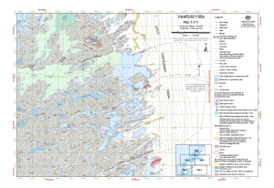
Map 13095: Vestfold Hills : Map 3 of 5
Map details
| Map Number | 13095 |
| Title | Vestfold Hills : Map 3 of 5 |
| Edition | 1 (Out of Date) |
| Next Edition | [Next Edition : 2] |
| Scale | 1 : 50 000 |
| Publication date | August 2004 |
| Publisher |
Australian Antarctic Division (Australia)
|
| Spatial coverage |
( 78.3250° -68.4500°)
,
( 78.6500° -68.4500°)
,
( 78.6500° -68.5694°)
( 78.3250° -68.5694°) |
| Projection | Universal Transverse Mercator |
| Physical size | - |
| Keywords | Vestfold Hills , Breid Basin , Tryne Fjord , Long Fjord , Lake Zvezda , Lake Bisernoye , Survey Marks , Topographic |
Downloads
This is a digital map available for downloading.
Map Lists
No maps lists available.
Additional Information
| Horizontal datum | WGS 84 |
| Vertical datum | Mean sea level |
| Nomenclature | Australian Antarctic Gazetteer |
Preview