Map 13112: Prince Charles Mountains, Lambert Glacier, Amery Ice Shelf: North
Map details
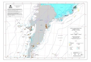
| Map Number | 13112 |
| Title | Prince Charles Mountains, Lambert Glacier, Amery Ice Shelf: North |
| Edition | 1 |
| Scale | 1 : 2 000 000 |
| Publication date | October 2004 |
| Publisher |
Australian Antarctic Division (Australia)
|
| Spatial coverage |
( 61.0000° -68.0000°)
,
( 83.0000° -68.0000°)
,
( 83.0000° -73.1667°)
( 61.0000° -73.1667°) |
| Projection | Lambert Conformal Conic |
| Physical size | 29.7 x 42 cm A3 |
| Keywords | Prince Charles Mountains , Lambert Glacier , Amery Ice Shelf , Mawson ESCARpment , Grove Mountains , Topographic |
Downloads
This is a digital map available for downloading.
Map Lists
This map belongs to the following lists. Use the link on the list to see all maps belonging to that list
Additional Information
| Horizontal datum | WGS 84 |
| Vertical datum | Mean Sea Level |
| Magnetic variation | 66 deg. 30' west at Mawson, 78 deg. 45' west at Davis, 71 deg. 04' west at Mt Cresswell |
| Nomenclature | Australian Antarctic Names Gazetteer |
Preview