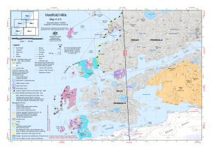
Map 13149: Vestfold Hills : Map 4 of 5
Map details
| Map Number | 13149 |
| Title | Vestfold Hills : Map 4 of 5 |
| Edition | 2 (Out of Date) |
| Previous edition | [Previous edition : 1] |
| Next Edition | [Next Edition : 3] |
| Scale | 1 : 50 000 |
| Publication date | September 2005 |
| Publisher |
Australian Antarctic Division (Australia)
|
| Spatial coverage |
( 77.1667° -68.5556°)
,
( 78.2000° -68.5556°)
,
( 78.2000° -68.6694°)
( 77.1667° -68.6694°) |
| Projection | Universal Transverse Mercator |
| Physical size | - |
| Keywords | Vestfold Hills , Broad Peninsula , Mule Peninsula , Donskiye Islands , Crooked Fjord , Adamson Bay , Ellis Fjord , Topographic |
Downloads
This is a digital map available for downloading.
Map Lists
No maps lists available.
Additional Information
| Horizontal datum | WGS 84 |
| Vertical datum | Mean sea level |
| Magnetic variation | The diagram on the map is for the zone 44 part of the map. In the zone 43 part of the map, Magnetic North is west of Grid North by 76 degrees and Grid North is west of True North by 2.7 degrees. |
| Nomenclature | Australian Antarctic Names Gazetteer |
Preview