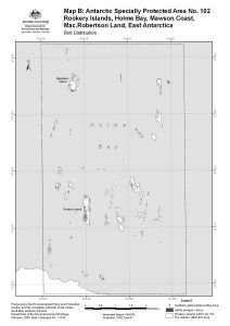
Map 13169: Rookery Islands, Holme Bay, Mawson Coast. Map B : Antarctic Specially Protected Area no. 102. Bird distribution
Map details
| Map Number | 13169 |
| Title | Rookery Islands, Holme Bay, Mawson Coast. Map B : Antarctic Specially Protected Area no. 102. Bird distribution |
| Edition | 1 (Out of Date) |
| Next Edition | [Next Edition : 2] |
| Scale | 1 : 36 000 |
| Publication date | February 2006 |
| Publisher |
Australian Antarctic Division (Australia)
|
| Spatial coverage |
( 62.4500° -67.5625°)
,
( 62.5972° -67.5625°)
,
( 62.5972° -67.6361°)
( 62.4500° -67.6361°) |
| Projection | Universal Transverse Mercator |
| Physical size | - |
| Keywords | Rookery Islands , Giganteus Island , ASPA 102 , Antarctic Specially Protected Area No. 102 |
Downloads
This is a digital map available for downloading.
Map Lists
No maps lists available.
Additional Information
| Horizontal datum | WGS84 |
| Nomenclature | Australian Antarctic Names Gazetteer |
Preview