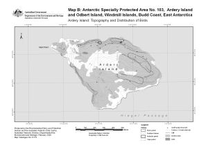
Map 13170: Ardery Island : Topography and distribution of birds. Map B : Antarctic Specially Protected area no. 103
Map details
| Map Number | 13170 |
| Title | Ardery Island : Topography and distribution of birds. Map B : Antarctic Specially Protected area no. 103 |
| Edition | 1 (Out of Date) |
| Next Edition | [Next Edition : 2] |
| Scale | 1 : 7500 |
| Publication date | February 2006 |
| Publisher | - |
| Spatial coverage |
(110.4306° -66.3667°)
,
(110.4722° -66.3667°)
,
(110.4722° -66.3758°)
(110.4306° -66.3758°) |
| Projection | Universal Transverse Mercator |
| Physical size | - |
| Keywords | Ardery Island , ASPA 103 , Antarctic Specially Protected Area No. 103 |
Downloads
This is a digital map available for downloading.
Map Lists
No maps lists available.
Additional Information
| Horizontal datum | WGS84 |
| Nomenclature | Australian Antarctic Names Gazetteer |
Preview