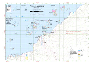
Map 13182: Framnes Mountains : Map 1 of 4
Map details
| Map Number | 13182 |
| Title | Framnes Mountains : Map 1 of 4 |
| Edition | 1 (Out of Date) |
| Next Edition | [Next Edition : 2] |
| Scale | 1 : 50 000 |
| Publication date | September 2005 |
| Publisher |
Australian Antarctic Division (Australia)
|
| Spatial coverage |
( 62.6597° -67.5428°)
,
( 63.1089° -67.5428°)
,
( 63.1089° -67.6594°)
( 62.6597° -67.6594°) |
| Projection | Universal Transverse Mercator |
| Physical size | - |
| Keywords | Mawson , Holme Bay , Kista Strait , Welch Island , Klung Islands , Ring Rock , Trevillian Island , Arrow Island , Bechervaise Island , Evans Island , Nost Island , Van Hulssen Islands , Rouse Islands , Teyssier Island , Topographic |
Downloads
This is a digital map available for downloading.
Map Lists
No maps lists available.
Additional Information
| Horizontal datum | WGS84 |
| Vertical datum | Mean sea level |
| Vertical unit | Metres |
| Magnetic variation | 66 degrees west of north |
| Nomenclature | Australian Antarctic Names Gazetteer |
Preview