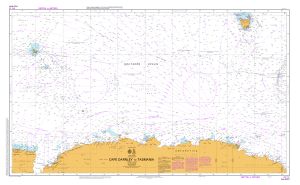
Map 13213: Aus 4074 Southern Ocean - Cape Darnley to Tasmania
Map details
| Map Number | 13213 |
| Title | Aus 4074 Southern Ocean - Cape Darnley to Tasmania |
| Edition | 3 |
| Scale | 1 : 10 000 000 |
| Publication date | September 2004 |
| Publisher |
Hydrographic Service, Department of the Navy, Wollongong (Australia)
|
| Spatial coverage |
( 61.3000° -40.0000°)
,
(149.3333° -40.0000°)
,
(149.3333° -70.6333°)
( 61.3000° -70.6333°) |
| Projection | Mercator |
| Physical size | 73 x 119 cm |
| Notes | Small corrections between editions. |
| Reference | Aus 4074, Int 74 (S31) |
| Keywords | Cape Darnley , Aus 4074 , Int 74 , Chart , Nautical , Chart |
Downloads
Map Lists
This map belongs to the following lists. Use the link on the list to see all maps belonging to that list
Additional Information
Preview