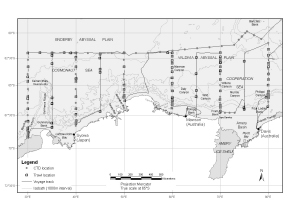
Map 13378: Voyage 3 2005/06 (BROKE-West)
Transects and undersea features [Black and white]
Map details
| Map Number | 13378 |
| Title | Voyage 3 2005/06 (BROKE-West) Transects and undersea features [Black and white] |
| Edition | 1 |
| Scale | 1 : 14 000 000 |
| Publication date | April 2007 |
| Publisher |
Australian Antarctic Division (Australia)
|
| Spatial coverage |
( 27.9667° -58.5333°)
,
( 82.8333° -58.5333°)
,
( 82.8333° -72.8833°)
( 27.9667° -72.8833°) |
| Projection | Mercator |
| Physical size | 12 x 19 cm |
| Notes | This map shows transects along the track of Voyage 3 of the Australian Antarctic Program 2005/06 and undersea features in the vicinity of the transects. CTD and trawl locations are also shown. |
| Keywords | Australian Antarctic Program , Broke-West 2005/06 , Undersea , Enderby Abyssal Plain , Valdivia Abyssal Plain , Cooperation Sea , Cosmonaut Sea , Brokewest , Broke West , Ship Tracks |
Downloads
This is a digital map available for downloading.
Map Lists
No maps lists available.
Additional Information
| Horizontal datum | WGS84 |
Preview
