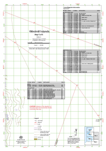
Map 13430: Windmill Islands : Map 5 of 5
Map details
| Map Number | 13430 |
| Title | Windmill Islands : Map 5 of 5 |
| Edition | 2 (Out of Date) |
| Previous edition | [Previous edition : 1] |
| Next Edition | [Next Edition : 3] |
| Scale | 1 : 50 000 |
| Publication date | October 2007 |
| Publisher |
Australian Antarctic Division (Australia)
|
| Spatial coverage |
(110.7714° -66.2900°)
,
(111.0731° -66.2900°)
,
(111.0731° -66.4650°)
(110.7714° -66.4650°) |
| Projection | Universal Transverse Mercator |
| Physical size | 29.7 x 42 cm A3 |
| Notes | Includes waypoint information as at September 2007 |
| Keywords | Windmill Islands , Casey Waypoint Information , Survey Marks , Topographic |
Downloads
This is a digital map available for downloading.
Map Lists
No maps lists available.
Additional Information
| Horizontal datum | WGS 84 |
| Vertical datum | Mean sea level |
| Nomenclature | Australian Antarctic Names Gazetteer |
Preview