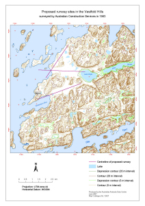
Map 13437: Proposed runway sites in the Vestfold Hills
surveyed by Australian Construction Services in 1983
Map details
| Map Number | 13437 |
| Title | Proposed runway sites in the Vestfold Hills surveyed by Australian Construction Services in 1983 |
| Edition | 1 |
| Scale | 1 : 37 000 |
| Publication date | June 2007 |
| Publisher |
Australian Antarctic Division (Australia)
|
| Spatial coverage |
( 77.9253° -68.5292°)
,
( 78.0786° -68.5292°)
,
( 78.0786° -68.5925°)
( 77.9253° -68.5925°) |
| Projection | Universal Transverse Mercator |
| Physical size | 42 x 29.7 cm A3 |
| Notes |
Map produced for Peter Magill (AAD Engineering) and Dr David Brown (Geoscience Australia). An A4 map with the same title was also created - see Mapcat ref. 13436. The runway centrelines are shown in a map published in ANARE Research Notes no. 98. Refer to the metadata record "Geology of possible runway sites in the Davis region, Vestfold Hills, East Antarctica" which can be accessed at: http://gcmd.nasa.gov/KeywordSearch/Home.do?Portal=amd_au&MetadataType=0 |
| Keywords | Runway Sites , Vestfold Hills , Australian Construction Services , Lake Dingle , Heidemann Bay |
Downloads
This is a digital map available for downloading.
Map Lists
This map belongs to the following lists. Use the link on the list to see all maps belonging to that list
Additional Information
| Horizontal datum | WGS84 |
| Nomenclature | Australian Antarctic Names Gazetteer |
Preview
