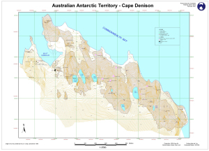
Map 13446: Australian Antarctic Territory - Cape Denison : Survey marks
Map details
| Map Number | 13446 |
| Title | Australian Antarctic Territory - Cape Denison : Survey marks |
| Edition | 1 |
| Scale | 1 : 2500 |
| Publication date | February 2001 |
| Publisher | - |
| Spatial coverage |
(142.6528° -67.0042°)
,
(142.6911° -67.0042°)
,
(142.6911° -67.0161°)
(142.6528° -67.0161°) |
| Projection | Universal Transverse Mercator |
| Physical size | 60 x 84 cm |
| Notes | The map shows the survey marks and survey traverse from Greg Crispo's December 1985 survey. |
| Keywords | Commonwealth Bay , Boat Harbour , Cape Denison , Survey Marks , Round Lake , Long Lake , Alga Lake , High Lake , Low Lake , East Lake , Survey Marks , Topographic |
Downloads
This is a digital map available for downloading.
Map Lists
This map belongs to the following lists. Use the link on the list to see all maps belonging to that list
Additional Information
| Horizontal datum | WGS84 |
| Vertical datum | Mean Sea Level |
| Nomenclature | Australian Antarctic Gazetteer |
Preview