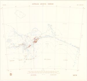
Map 135: SQ 47-48
Map details
| Map Number | 135 |
| Title | SQ 47-48 |
| Edition | 1 (Out of Date) |
| Next Edition | [Next Edition : 2] |
| Scale | 1 : 1 000 000 |
| Publication date | August 1969 |
| Publisher |
Department of National Development, Division of National Mapping (Australia)
|
| Spatial coverage |
( 96.0000° -64.0000°)
,
(108.0000° -64.0000°)
,
(108.0000° -68.0000°)
( 96.0000° -68.0000°) |
| Projection | Lambert Conformal Conic |
| Physical size | - |
| Notes | Compilation Map |
| Reference |
SQ47-48 NMP/69/118 |
| Keywords | Survey Marks , Queen Mary Land , Wilkes Land |
Downloads
This is a hard copy map that has been scanned. See information about obtaining copies of hard copy maps.
- A LZW compressed TIFF
- A print file (PDF)
- National Library of Australia Bib ID 4549539 (External site)
- National Library of Australia Bib ID 4550534 (External site)
Map Lists
No maps lists available.
Additional Information
Preview