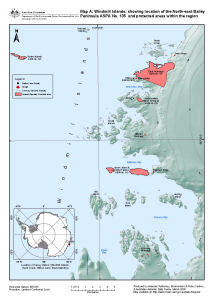
Map 13511: Windmill Islands, showing location of the North-east Bailey Peninsula ASPA No. 135 and protected areas within the region (Map A)
Map details
| Map Number | 13511 |
| Title | Windmill Islands, showing location of the North-east Bailey Peninsula ASPA No. 135 and protected areas within the region (Map A) |
| Edition | 2 (Out of Date) |
| Previous edition | [Previous edition : 1] |
| Next Edition | [Next Edition : 3] |
| Scale | 1 : 142 857 |
| Publication date | March 2008 |
| Publisher |
Australian Antarctic Division (Australia)
|
| Spatial coverage |
(110.2500° -66.1667°)
,
(110.8667° -66.1667°)
,
(110.8667° -66.5333°)
(110.2500° -66.5333°) |
| Projection | Lambert Conformal Conic |
| Physical size | - |
| Notes | Inset: Location of Casey Station, Windmill Islands, Budd Coast, Wilkes Land |
| Keywords | Clark Peninsula , ASPA 136 , North-East Bailey Peninsula , ASPA 135 , Jack's Donga , Ardery Island And Odbert Island , ASPA 103 , Frazier Islands ASPA 160 |
Downloads
This is a digital map available for downloading.
Map Lists
No maps lists available.
Additional Information
| Horizontal datum | WGS84 |
| Nomenclature | Australian Antarctic Gazetteer |
Preview