Map 13564: Vestfold Hills Davis Station approach : Map 6 of 6
Map details
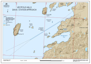
| Map Number | 13564 |
| Title | Vestfold Hills Davis Station approach : Map 6 of 6 |
| Edition | 1 |
| Scale | 1 : 20 000 |
| Publication date | October 2008 |
| Publisher |
Australian Antarctic Division (Australia)
|
| Spatial coverage |
( 77.8361° -68.5564°)
,
( 78.0353° -68.5564°)
,
( 78.0353° -68.5994°)
( 77.8361° -68.5994°) |
| Projection | Universal Transverse Mercator |
| Physical size | - |
| Notes | Map produced in limited time to aid planning for the emergency evacuation of an injured expeditioner from Davis. |
| Keywords | Proposed Emergency Runway , Approach Splays , Gardner Island , Hobby Rocks , Torckler Rocks , Anchorage Island , Trigwell Island , Bunning Hill , Emergency Evacuation |
Downloads
This is a digital map available for downloading.
Map Lists
No maps lists available.
Additional Information
| Horizontal datum | WGS84 |
| Vertical datum | msl |
Preview