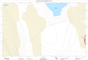
Map 13573: Cape Denison: Main Hut to ANARE wind pole
Map details
| Map Number | 13573 |
| Title | Cape Denison: Main Hut to ANARE wind pole |
| Edition | 1 |
| Scale | 1 : 150 |
| Publication date | November 2008 |
| Publisher |
Australian Antarctic Division (Australia)
|
| Spatial coverage |
(142.6579° -67.0083°)
,
(142.6608° -67.0083°)
,
(142.6608° -67.0089°)
(142.6579° -67.0089°) |
| Projection | Universal Transverse Mercator |
| Physical size | 59.8 x 87.8 cm |
| Notes | Map produced to aid searching for artifacts in the ice during the 2008/09 Mawson's Huts Foundation Expedition |
| Keywords | Cape Denison Hut , Boat Harbour , Anare Wind Pole , Topographic |
Downloads
This is a digital map available for downloading.
Map Lists
No maps lists available.
Additional Information
| Horizontal datum | WGS84 |
| Vertical datum | Mean sea level |
Preview