Map 13676: South Shetland Islands : Elephant, Clarence and Gibbs Islands
Map details
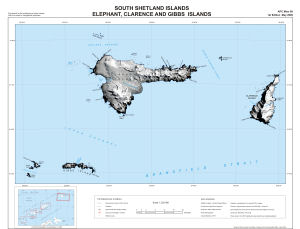
| Map Number | 13676 |
| Title | South Shetland Islands : Elephant, Clarence and Gibbs Islands |
| Edition | 1 |
| Scale | 1 : 220 000 |
| Publication date | May 2009 |
| Publisher |
Antarctic Place-Names Committee, Foreign and Commonwealth Office (United Kingdom)
|
| Spatial coverage |
( -56.0667° -60.9500°)
,
( -53.9333° -60.9500°)
,
( -53.9333° -61.5500°)
( -56.0667° -61.5500°) |
| Projection | Polar Stereographic |
| Physical size | 45 x 60 cm |
| Notes | Inset: Location diagram from BAS Misc 14, 2009 |
| Reference | APC Misc 99 |
| Keywords | Elephant Island , Clarence Island , Gibbs Island , Endurance Glacier , Mount Irving , Aspland Island , Eadie Island , Loper Channel , Sealers Passage , Prince Charles Strait , Cornwallis Island , Apc Misc 99 , Topographic |
Downloads
No downloads available.
This is a hard copy map. See information about obtaining copies of hard copy maps.
Map Lists
No maps lists available.
Additional Information
| Horizontal datum | WGS84 |
| Nomenclature | BAT Gazetteer |
Preview