Map 13678: South Shetland Islands : Greenwich, Robert and Nelson Islands
Map details
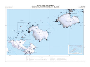
| Map Number | 13678 |
| Title | South Shetland Islands : Greenwich, Robert and Nelson Islands |
| Edition | 9 |
| Scale | 1 : 100 000 |
| Publication date | May 2009 |
| Publisher |
UK Antarctic Place-names Committee (United Kingdom)
|
| Spatial coverage |
( -60.1167° -62.2167°)
,
( -58.7833° -62.2167°)
,
( -58.7833° -62.5667°)
( -60.1167° -62.5667°) |
| Projection | Polar Stereographic |
| Physical size | 51 x 74.5 cm |
| Notes | Inset: Location diagram from BAS Misc 14, 2009 |
| Reference | APC Misc 65 |
| Keywords | Greenwich Island , Robert Island , Nelson Island , Discovery Bay , Orion Passage , Yankee Harbour , English Strait , Nelson Strait , Harmony Cove , Edgell Bay , Maxwell Bay , Aitcho Islands , Apc Misc 65 , Topographic |
Downloads
Map Lists
No maps lists available.
Additional Information
| Horizontal datum | WGS84 |
| Nomenclature | BAT Gazetteer |
Preview