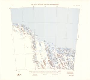
Map 137: SR 57-58
Map details
| Map Number | 137 |
| Title | SR 57-58 |
| Edition | 1 (Out of Date) |
| Next Edition | [Next Edition : 2] |
| Scale | 1 : 1 000 000 |
| Publication date | 1975 |
| Publisher |
Department of National Development, Division of National Mapping (Australia)
|
| Spatial coverage |
(156.0000° -68.0000°)
,
(168.0000° -68.0000°)
,
(168.0000° -72.0000°)
(156.0000° -72.0000°) |
| Projection | Lambert Conformal Conic |
| Physical size | 58 x 63 cm |
| Notes | Compilation Map |
| Reference |
SR 57-58 NMP/70/167 |
| Keywords | Ross Dependency , Oates Land , Victoria Land , Survey Marks , Topographic , Rennick Glacier , Matusevich Glacier , SR57-58 |
Downloads
This is a hard copy map that has been scanned. See information about obtaining copies of hard copy maps.
- A print file (PDF)
- National Library of Australia Bib ID 4550403 (External site)
- A LZW compressed TIFF
Map Lists
No maps lists available.
Additional Information
Preview