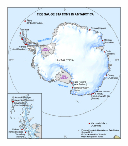
Map 13758: Tide Gauge Stations in Antarctica
Map details
| Map Number | 13758 |
| Title | Tide Gauge Stations in Antarctica |
| Edition | 1 |
| Scale | 1 : 44 000 000 |
| Publication date | October 2010 |
| Publisher |
Australian Antarctic Division (Australia)
|
| Spatial coverage |
(-180.0000° 90.0000°)
,
(180.0000° 90.0000°)
,
(180.0000° -60.0000°)
(-180.0000° -60.0000°) |
| Projection | Polar Stereographic |
| Physical size | 17.5 x 15 cm |
| Notes |
The scale of the inset is 1:10000000. True scale at 71°S. |
| Keywords | - |
Downloads
This is a digital map available for downloading.
Map Lists
This map belongs to the following lists. Use the link on the list to see all maps belonging to that list
Additional Information
| Horizontal datum | WGS84 |
Preview