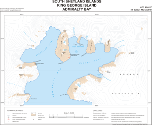
Map 13796: South Shetland Islands : King George Island, Admiralty Bay
Map details
| Map Number | 13796 |
| Title | South Shetland Islands : King George Island, Admiralty Bay |
| Edition | 5 |
| Scale | 1 : 40 000 |
| Publication date | March 2010 |
| Publisher |
UK Antarctic Place-names Committee (United Kingdom)
|
| Spatial coverage |
( -58.5381° -62.0419°)
,
( -58.2189° -62.0419°)
,
( -58.2189° -62.1356°)
( -58.5381° -62.1356°) |
| Projection | Polar Stereographic |
| Physical size | 38.5 x 49.2 cm |
| Notes |
Provisional for the positioning of place-names Not to be used for navigational purposes |
| Reference | APC Misc 67 |
| Keywords | South Shetland Islands , King George Island , Admiralty Bay , Mackellar Inlet , Martel Inlet , Krakow Peninsula , Keller Peninsula , Dragon Glacier , Survey Marks , Topographic |
Downloads
This is a digital map available for downloading.
Map Lists
No maps lists available.
Additional Information
| Horizontal datum | WGS84 |
| Nomenclature | BAT Gazetteer |
Preview