Map 13801: South Shetland Islands : Livingston Island, Byers Peninsula
Map details
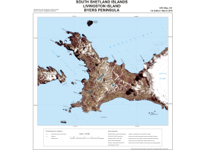
| Map Number | 13801 |
| Title | South Shetland Islands : Livingston Island, Byers Peninsula |
| Edition | 1 |
| Scale | 1 : 50 000 |
| Publication date | March 2010 |
| Publisher |
UK Antarctic Place-names Committee (United Kingdom)
|
| Spatial coverage |
( -61.2775° -62.5589°)
,
( -60.9158° -62.5589°)
,
( -60.9158° -62.6933°)
( -61.2775° -62.6933°) |
| Projection | Polar Stereographic |
| Physical size | 43.7 x 43 cm |
| Notes |
Provisional for the positioning of place names Not to be used for navigational purposes |
| Reference | APC Misc 101 |
| Keywords | South Shetland Islands , Livingston Island , Byers Peninsula , Apc Misc 101 , Rotch Dome , New Plymouth , Barclay Bay , Rugged Island , Window Island , Robbery Beaches , Satellite Imagery |
Downloads
This is a digital map available for downloading.
Map Lists
No maps lists available.
Additional Information
| Horizontal datum | WGS84 |
| Nomenclature | BAT Gazetteer |
Preview