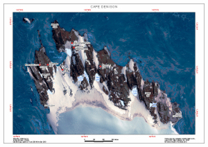
Map 13855: Cape Denison
Map details
| Map Number | 13855 |
| Title | Cape Denison |
| Edition | 1 |
| Scale | 1 : 7500 |
| Publication date | August 2010 |
| Publisher |
Australian Antarctic Division (Australia)
|
| Spatial coverage |
(142.6486° -67.0031°)
,
(142.6933° -67.0031°)
,
(142.6933° -67.0147°)
(142.6486° -67.0147°) |
| Projection | Universal Transverse Mercator |
| Physical size | 21 x 29.7 cm A4 |
| Notes |
This map is to be included in the book "Douglas Mawson's Antarctic Bases Macquarie Island, Cape Denison and the Shackleton Ice Shelf" to be published by the Mawson's Huts Foundation. |
| Keywords | Mawson's Huts , Mawsons Huts , Commonwealth Bay , Satellite Imagery |
Downloads
This is a digital map available for downloading.
Map Lists
This map belongs to the following lists. Use the link on the list to see all maps belonging to that list
Additional Information
| Horizontal datum | WGS84 |
Preview