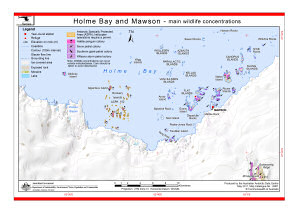
Map 13901: Holme Bay and Mawson - main wildlife concentrations (Helicopter Operations)
Map details
| Map Number | 13901 |
| Title | Holme Bay and Mawson - main wildlife concentrations (Helicopter Operations) |
| Edition | 1 |
| Scale | 1 : 160 000 |
| Publication date | May 2011 |
| Publisher | - |
| Spatial coverage |
( 62.1520° -67.4880°)
,
( 63.1190° -67.4880°)
,
( 63.1190° -68.7060°)
( 62.1520° -68.7060°) |
| Projection | Universal Transverse Mercator |
| Physical size | 21 x 29.7 cm A4 |
| Keywords | - |
Downloads
This is a digital map available for downloading.
Map Lists
This map belongs to the following lists. Use the link on the list to see all maps belonging to that list
Additional Information
| Horizontal datum | WGS84 |
| Vertical datum | Mean sea level |
| Nomenclature | Australian Antarctic Names Gazetteer |
Preview