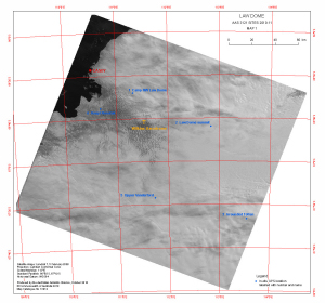
Map 13914: Law Dome
AAS 3121 Sites 2010-11
Map 1
Map details
| Map Number | 13914 |
| Title | Law Dome AAS 3121 Sites 2010-11 Map 1 |
| Edition | 1 |
| Scale | 1 : 931 500 |
| Publication date | October 2010 |
| Publisher |
Australian Antarctic Division (Australia)
|
| Spatial coverage |
(108.9714° -65.8489°)
,
(114.7725° -65.8489°)
,
(114.7725° -68.0081°)
(108.9714° -68.0081°) |
| Projection | Lambert Conformal Conic |
| Physical size | 28 x 30 cm |
| Notes |
This map is one of two maps showing the proposed locations of in-situ GPS to be set up during the 2010-11 summer for Australian Antarctic Science Project 3121 lead by Dr Christopher Watson, Surveying and Spatial Science Group, School of Geography and Environmental Studies, University of Tasmania. Some locations used may differ from those shown on the map. See also map 13915. |
| Keywords | Australian Antarctic Science Project , Watson |
Downloads
This is a digital map available for downloading.
Map Lists
This map belongs to the following lists. Use the link on the list to see all maps belonging to that list
Additional Information
| Horizontal datum | WGS84 |
Preview