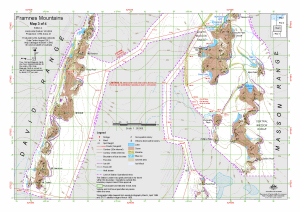
Map 13942: Framnes Mountains : Map 3 of 4
Map details
| Map Number | 13942 |
| Title | Framnes Mountains : Map 3 of 4 |
| Edition | 4 (Out of Date) |
| Previous edition | [Previous edition : 3] |
| Next Edition | [Next Edition : 5] |
| Scale | 1 : 50 000 |
| Publication date | August 2011 |
| Publisher |
Australian Antarctic Division (Australia)
|
| Spatial coverage |
( 62.4742° -67.7594°)
,
( 62.9275° -67.7594°)
,
( 62.9275° -67.8761°)
( 62.4742° -67.8761°) |
| Projection | Universal Transverse Mercator |
| Physical size | 29.7 x 42 cm A3 |
| Keywords | David Range , Masson Range , Fang Peak , Mt Elliott , Mt Lawrence , Mt Coates , Mt Parsons , Rumdoodle Peak , Dallice Peak , Ferguson Peak , Phillips Ridge , Sonic Lake , Topographic |
Downloads
This is a digital map available for downloading.
Map Lists
No maps lists available.
Additional Information
| Horizontal datum | WGS84 |
| Vertical datum | Mean sea level |
| Vertical unit | Metres |
| Magnetic variation | 67 degrees west of north |
| Nomenclature | Australian Antarctic Gazetteer |
Preview