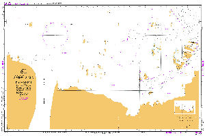
Map 13990: Gibbney Island to Kista Strait
Map details
| Map Number | 13990 |
| Title | Gibbney Island to Kista Strait |
| Edition | 1 |
| Scale | 1 : 25 000 |
| Publication date | 14 January 2011 |
| Publisher |
Australia
Hydrographic Service, Department of the Navy, Wollongong (Australia) |
| Spatial coverage |
( 62.2567° -67.5333°)
,
( 62.8550° -67.5333°)
,
( 62.8550° -67.6883°)
( 62.2567° -67.6883°) |
| Projection | Transverse Mercator |
| Physical size | 72.9 x 110.5 cm |
| Reference | Aus 599, INT 9037 |
| Keywords | Aus 599 , Int 9037 , Parallactic Islands , Kellas Islands , Van Hulssen Islands , Gibbney Island , Arrow Island , Giganteus Island , Peake-Jones Rock , Nost Island , Baseline Rock , Trevillian Island , Chart , Nautical , Chart |
Downloads
No downloads available.
This is a hard copy map. See information about obtaining copies of hard copy maps.
Map Lists
This map belongs to the following lists. Use the link on the list to see all maps belonging to that list
Additional Information
| Horizontal datum | WGS84 |
| Nomenclature | Australian Antarctic Gazetteer |
Preview