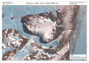
Map 13995: Beaver Lake and Loewe Massif
Map details
| Map Number | 13995 |
| Title | Beaver Lake and Loewe Massif |
| Edition | 1 |
| Scale | Not Entered |
| Publication date | October 2011 |
| Publisher |
Australian Antarctic Division (Australia)
|
| Spatial coverage |
( 67.3008° -70.4900°)
,
( 68.3728° -70.4900°)
,
( 68.3728° -70.7233°)
( 67.3008° -70.7233°) |
| Projection | Universal Transverse Mercator |
| Physical size | - |
| Notes | Map produced for field work associated with Australian Antarctic Science Project 2355 lead by Dr Mark Stevens of the South Australian Museum |
| Keywords | Beaver Lake , Loewe Massif , Manning Massif , Amery Peaks , Mckinnon Glacier , Satellite Imagery |
Downloads
This is a digital map available for downloading.
Map Lists
This map belongs to the following lists. Use the link on the list to see all maps belonging to that list
Additional Information
| Horizontal datum | WGS84 |
| Nomenclature | Australian Antarctic Names Gazetteer |
Preview