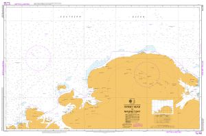
Map 14012: Aus 448 Australian Antarctic Territory - Kirkby Head to Magnet Bay
Map details
| Map Number | 14012 |
| Title | Aus 448 Australian Antarctic Territory - Kirkby Head to Magnet Bay |
| Edition | 1 |
| Scale | 1 : 500 000 |
| Publication date | December 2011 |
| Publisher |
Hydrographic Service, Department of the Navy, Wollongong (Australia)
|
| Spatial coverage |
( 45.0000° -64.6333°)
,
( 57.3500° -64.6333°)
,
( 57.3500° -67.7833°)
( 45.0000° -67.7833°) |
| Projection | Mercator |
| Physical size | 73.5 x 110.5 cm |
| Reference | Aus 448, Int 9038 |
| Keywords | Kirky Head , Magnet Bay , Aus 448 , Int 9038 , Napier Mountains , Tange Promontory , Sakellari Peninsula , Chart , Nautical , Chart |
Downloads
Map Lists
This map belongs to the following lists. Use the link on the list to see all maps belonging to that list
Additional Information
| Horizontal datum | WGS84 |
| Nomenclature | Australian Antarctic Gazetteer |
Preview