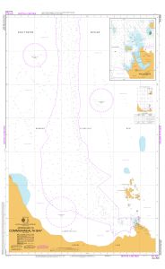
Map 14023: Aus 603 Australian Antarctic Territory - George V Land - Approaches to Commonwealth Bay
Map details
| Map Number | 14023 |
| Title | Aus 603 Australian Antarctic Territory - George V Land - Approaches to Commonwealth Bay |
| Edition | 2 |
| Scale | 1 : 25 000 |
| Publication date | July 2011 |
| Publisher |
Hydrographic Service, Department of the Navy, Wollongong (Australia)
|
| Spatial coverage |
(142.3333° -66.8000°)
,
(142.7067° -66.8000°)
,
(142.7067° -67.0333°)
(142.3333° -67.0333°) |
| Projection | Transverse Mercator |
| Physical size | 110 x 70 cm |
| Notes |
Magnetic compasses are not to be relied upon in the area covered by this chart because of the proximity of the South magnetic pole. Mariners should refer to chart BA 5385 and the Admiralty Sailing Directions for further information. Inset of Boat Harbour at Scale 1:5000. Small corrections between editions. |
| Reference | AUS 603, INT 9014 |
| Keywords | Commonwealth Bay , Cape Denison , Boat Harbour , Southern Ocean , Dumont D'urville Sea , Aus603 , Mackellar Islands , South Magnetic Pole , Aus603 , Int 9014 , Chart , Nautical , Chart |
Downloads
Map Lists
This map belongs to the following lists. Use the link on the list to see all maps belonging to that list
Additional Information
| Horizontal datum | WGS84 |
| Vertical datum | Lowest astronomical tide |
| Magnetic variation | Not applicable - see note |
Preview