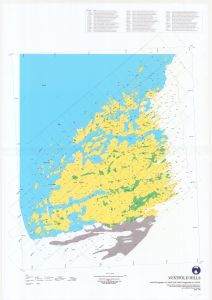
Map 14042: Vestfold Hills : Aerial photography for 1996/97 and aerial triangulation for 1994/95
Map details
| Map Number | 14042 |
| Title | Vestfold Hills : Aerial photography for 1996/97 and aerial triangulation for 1994/95 |
| Edition | 1 |
| Scale | 1 : 50 000 |
| Publication date | April 1998 |
| Publisher |
Australian Antarctic Division (Australia)
|
| Spatial coverage |
( 77.7833° -68.3333°)
,
( 78.6750° -68.3333°)
,
( 78.6750° -68.7333°)
( 77.7833° -68.7333°) |
| Projection | Universal Transverse Mercator |
| Physical size | 122.5 x 85 cm |
| Notes | Includes unique identifiers for lakes in the Vestfold Hills area Lakes of the Vestfold Hills area |
| Keywords | Flight Lines , Triangulation , Lakes , Broad Peninsula , Long Peninsula , Mule Peninsula |
Downloads
Map Lists
No maps lists available.
Additional Information
| Horizontal datum | WGS 84 |
| Vertical datum | MSL |
Preview