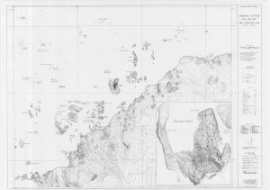
Map 14057: Preliminary - Mawson Station Local Area Map
Map details
| Map Number | 14057 |
| Title | Preliminary - Mawson Station Local Area Map |
| Edition | 2 |
| Scale | 1 : 25 000 |
| Publication date | November 1993 |
| Publisher |
Australian Surveying and Land Information Group, Department of Administrative Services, Canberra (Australia)
|
| Spatial coverage |
( 62.6667° -67.4833°)
,
( 63.2333° -67.4833°)
,
( 63.2333° -67.6583°)
( 62.6667° -67.6583°) |
| Projection | Universal Transverse Mercator |
| Physical size | 84 x 120 cm |
| Notes |
Inset: Horseshoe Harbour Preliminary 2nd ed. Includes more detailed topographic information than Mapcat 13133 |
| Keywords | Mawson Station , Local Area , Horseshoe Harbour , Survey Marks , Topographic |
Downloads
This is a hard copy map that has been scanned. See information about obtaining copies of hard copy maps.
Map Lists
No maps lists available.
Additional Information
| Horizontal datum | WGS84 |
| Vertical datum | MSL |
| Vertical unit | Metres |
| Nomenclature | Australian Antarctic Gazetteer |
Preview