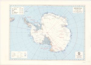
Map 14063: Antarctica
Map details
| Map Number | 14063 |
| Title | Antarctica |
| Edition | 1 (Out of Date) |
| Next Edition | [Next Edition : 3] |
| Scale | 1 : 20 000 000 |
| Publication date | 1965 |
| Publisher |
Department of National Development, Division of National Mapping (Australia)
|
| Spatial coverage |
(-180.0000° -50.0000°)
,
(180.0000° -50.0000°)
,
(180.0000° -90.0000°)
(-180.0000° -90.0000°) |
| Projection | Polar Stereographic |
| Physical size | 31 x 42.5 cm |
| Notes |
Antarctic Peninsula stations listed. Shows territorial claims |
| Reference | NMP/63/088 |
| Keywords | Antarctica And The Southern Ocean , Territorial Claims , Topographic |
Downloads
This is a hard copy map that has been scanned. See information about obtaining copies of hard copy maps.
Map Lists
No maps lists available.
Additional Information
Preview