Map 14109: Newcomb Bay
Map details
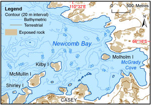
| Map Number | 14109 |
| Title | Newcomb Bay |
| Edition | 1 |
| Scale | 1 : 47 000 |
| Publication date | July 2012 |
| Publisher |
Australian Antarctic Division (Australia)
|
| Spatial coverage |
(110.4894° -66.2567°)
,
(110.5803° -66.2567°)
,
(110.5803° -66.2819°)
(110.4894° -66.2819°) |
| Projection | Universal Transverse Mercator |
| Physical size | 6 x 8.7 cm |
| Keywords | Newcomb Bay , Shirley Island , Mcmullin Island , Kilby Island , Molholm Island , Mcgrady Cove , Bathymetry |
Downloads
This is a digital map available for downloading.
Map Lists
This map belongs to the following lists. Use the link on the list to see all maps belonging to that list
Additional Information
| Nomenclature | Australian Antarctic Gazetteer |
Preview