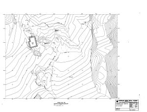
Map 14136: Commonwealth Bay (Antarctica)
Main hut and surround
Detail and contours
Map details
| Map Number | 14136 |
| Title | Commonwealth Bay (Antarctica) Main hut and surround Detail and contours |
| Edition | 1 |
| Scale | 1 : 200 |
| Publication date | |
| Publisher |
Australian Survey Office - Victoria (Australia)
|
| Spatial coverage |
(142.6596° -67.0082°)
,
(142.6647° -67.0082°)
,
(142.6647° -67.0095°)
(142.6596° -67.0095°) |
| Projection | Universal Transverse Mercator |
| Physical size | 84 x 105 cm |
| Notes |
Detail survey conducted by surveyor G. Crispo, December 1985. Plot on film. Drawing No. 3322/004 |
| Keywords | Cape Denison , Crispo , 1985 , 3322/004 , Topographic |
Downloads
This is a hard copy map that has been scanned. See information about obtaining copies of hard copy maps.
Map Lists
This map belongs to the following lists. Use the link on the list to see all maps belonging to that list
Additional Information
Preview