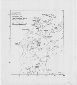
Map 14139: Davis Bathymetric Map
Map details
| Map Number | 14139 |
| Title | Davis Bathymetric Map |
| Edition | 1 |
| Scale | 1 : 18 200 |
| Publication date | 1984 |
| Publisher |
Australia
Australian Antarctic Division (Australia) |
| Spatial coverage |
( 77.8000° -68.5278°)
,
( 78.0000° -68.5278°)
,
( 78.0000° -68.6167°)
( 77.8000° -68.6167°) |
| Projection | Not Given |
| Physical size | 73.5 x 63.5 cm |
| Notes | Bathymetric map drawn from soundings taken by R. Williams, Jan-Feb 1984 |
| Keywords | R. Williams , Bathymetry , Donskiye Islands , Gardner Island , Barratt Island , Keuken Island , Turner Island , Lugg Island , Waterhouse Island , Anchorage Island , Bathymetry |
Downloads
This is a hard copy map that has been scanned. See information about obtaining copies of hard copy maps.
Map Lists
No maps lists available.
Additional Information
Preview