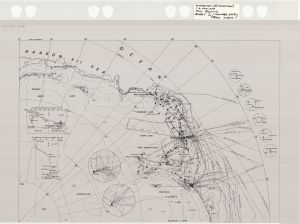
Map 14162: Draft - Antarctica : A.N.A.R.E. exploration 1948 to 1966 - Sheet 1
Map details
| Map Number | 14162 |
| Title | Draft - Antarctica : A.N.A.R.E. exploration 1948 to 1966 - Sheet 1 |
| Edition | - |
| Next Edition | [Next Edition : Draft] |
| Scale | 1 : 6 000 000 |
| Publication date | 1987 |
| Publisher |
Australian Surveying and Land Information Group, Department of Administrative Services, Canberra (Australia)
Australian Antarctic Division (Australia) |
| Spatial coverage |
(-180.0000° -60.0000°)
,
(180.0000° -60.0000°)
,
(180.0000° -90.0000°)
(-180.0000° -90.0000°) |
| Projection | Polar Stereographic |
| Physical size | 89 x 160 cm |
| Notes |
See also Sheet 4 (Map 15308) Preparation work for ANARE 1947-1966 (Map 14) |
| Keywords | Anare 1947-1966 , Phillip Law , Heroes' Map , Ship Tracks , Historical |
Downloads
This is a hard copy map that has been scanned. See information about obtaining copies of hard copy maps.
Map Lists
No maps lists available.
Additional Information
Preview