Map 14240: Australia, New Zealand, Antarctica EDTO Plotting Chart
Map details
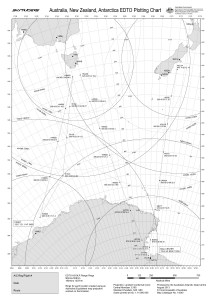
| Map Number | 14240 |
| Title | Australia, New Zealand, Antarctica EDTO Plotting Chart |
| Edition | 2 |
| Previous edition | [Previous edition : 1] |
| Scale | 1 : 14 000 000 |
| Publication date | August 2013 |
| Publisher |
Australian Antarctic Division (Australia)
|
| Spatial coverage |
( 94.0000° -33.0000°)
,
(-158.0000° -33.0000°)
,
(-158.0000° -79.0000°)
( 94.0000° -79.0000°) |
| Projection | Lambert Conformal Conic |
| Physical size | 42 x 29.7 cm A3 |
| Keywords | Aeronautical , Air Transport , Aeronautic , Chart |
Downloads
This is a digital map available for downloading.
Map Lists
This map belongs to the following lists. Use the link on the list to see all maps belonging to that list
Additional Information
| Horizontal datum | WGS84 |
Preview