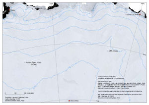
Map 14265: Aurora Basin North Ice Core Drilling Site
Location in relation to Casey, Dumont d'Urville and Concordia
Map details
| Map Number | 14265 |
| Title | Aurora Basin North Ice Core Drilling Site Location in relation to Casey, Dumont d'Urville and Concordia |
| Edition | 1 |
| Scale | 1 : 5 000 000 |
| Publication date | November 2013 |
| Publisher |
Australian Antarctic Division (Australia)
|
| Spatial coverage |
(106.2333° -66.2833°)
,
(144.3667° -66.2833°)
,
(144.3667° -75.2833°)
(106.2333° -75.2833°) |
| Projection | Lambert Conformal Conic |
| Physical size | 20.1 x 28.7 cm |
| Keywords | Satellite Imagery |
Downloads
This is a digital map available for downloading.
Map Lists
This map belongs to the following lists. Use the link on the list to see all maps belonging to that list
Additional Information
| Horizontal datum | WGS84 |
| Vertical datum | WGS84 |
Preview