Map 14321: Annex B: Casey Station Spill Risk Assessment Map
Land - Based Spills
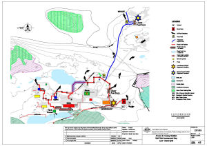
Map details
| Map Number | 14321 |
| Title | Annex B: Casey Station Spill Risk Assessment Map Land - Based Spills |
| Edition | 4 (Out of Date) |
| Previous edition | [Previous edition : 3] |
| Next Edition | [Next Edition : 5] |
| Scale | 1 : 2000 |
| Publication date | 07 July 2008 |
| Publisher |
Australian Antarctic Division (Australia)
|
| Spatial coverage |
(110.5181° -66.2775°)
,
(110.5444° -66.2775°)
,
(110.5444° -66.2833°)
(110.5181° -66.2833°) |
| Projection | Universal Transverse Mercator |
| Physical size | 42 x 59.4 cm A2 |
| Reference | C/01/03 |
| Keywords | Spill Risk , Drum Farm , Fixed Fuel Pipeline , Valve Drain Location , Mini Oil Spill Kit , ASPA No.135 |
Downloads
This is a digital map available for downloading.
Map Lists
No maps lists available.
Additional Information
Preview