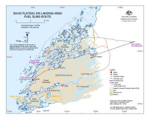
Map 14325: Davis Plateau Ski Landing Area
Fuel Sling Route
Map details
| Map Number | 14325 |
| Title | Davis Plateau Ski Landing Area Fuel Sling Route |
| Edition | 1 (Out of Date) |
| Next Edition | [Next Edition : 2] |
| Scale | 1 : 200 000 |
| Publication date | September 2014 |
| Publisher |
Australian Antarctic Division (Australia)
|
| Spatial coverage |
( 77.7236° -68.3411°)
,
( 78.9139° -68.3411°)
,
( 78.9139° -68.6956°)
( 77.7236° -68.6956°) |
| Projection | Universal Transverse Mercator |
| Physical size | 21 x 26.5 cm |
| Keywords | Vestfold Hills , Helicopter , External Load , Flight Lines , Aeronautic |
Downloads
This is a digital map available for downloading.
Map Lists
This map belongs to the following lists. Use the link on the list to see all maps belonging to that list
Additional Information
| Horizontal datum | WGS84 |
Preview