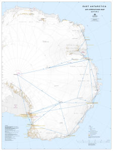
Map 14477: East Antarctica Air Operations Map
Map details
| Map Number | 14477 |
| Title | East Antarctica Air Operations Map |
| Edition | 2 |
| Previous edition | [Previous edition : 1] |
| Scale | 1 : 4 000 000 |
| Publication date | August 2015 |
| Publisher |
Australian Antarctic Division (Australia)
|
| Spatial coverage |
( -10.0000° -60.0000°)
,
(-170.0000° -60.0000°)
,
(-170.0000° -90.0000°)
( -10.0000° -90.0000°) |
| Projection | Polar Stereographic |
| Physical size | 122 x 91 cm |
| Notes | This map was produced for the Australian Antarctic program's air operations. |
| Keywords | Flight Route , Distance , Antarctic Specially Protected Area , Antarctic Specially Managed Area , ASPA , ASMA |
Downloads
This is a digital map available for downloading.
Map Lists
This map belongs to the following lists. Use the link on the list to see all maps belonging to that list
Additional Information
| Horizontal datum | WGS84 |
| Vertical datum | Mean Sea Level |
| Nomenclature | SCAR Gazetteer |
Preview