Map 14496: Henryk Arctowski Antarctic Station
Map details
| Map Number | 14496 |
| Title | Henryk Arctowski Antarctic Station |
| Edition | 1 |
| Scale | 1 : 500 |
| Publication date | November 2015 |
| Publisher |
Faculty of Geodesy and Cartography, Warsaw University of Technology (Poland)
|
| Spatial coverage |
( -58.4778° -62.1575°)
,
( -58.4644° -62.1575°)
,
( -58.4644° -62.1621°)
( -58.4778° -62.1621°) |
| Projection | Universal Transverse Mercator |
| Physical size | 116.1 x 146.1 cm |
| Notes |
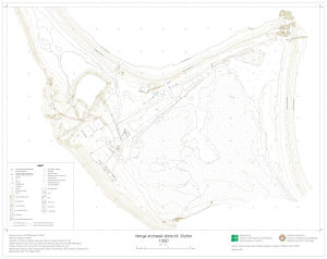
This master map shows the area of Henryk Arctowski Station together with a freshwater reservoir and a moss carpet formation named Jasnorzewski Gardens. The map was prepared during the 39th Polish Antarctic Expedition to the station in March 2015. Authors: Mariusz Pasik, Maria Elzbieta Kowalska, Slawomir Lapinski, Marcin Rajner. |
| Keywords | Antarctica , King George Island , Henryk Arctowski Antarctic Station , Admiralty Bay , Arctowski Cove , Jasnorzewski Gardens , Jasnorzewski Point , Master Map |
Downloads
This is a digital map available for downloading.
Map Lists
No maps lists available.
Additional Information
| Horizontal datum | Reference frame: ITRF2008 (epoch 2015.2), Reference ellipsoid: GRS80 |
| Vertical datum | Mean sea level of Admiralty Bay based on daily recordings of minimal and maximal levels between 1998 and 1999 |
Preview