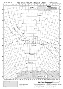
Map 14549: Cape Town to Troll EDTO Plotting Chart
Map details
| Map Number | 14549 |
| Title | Cape Town to Troll EDTO Plotting Chart |
| Edition | 1 |
| Scale | 1 : 14 000 000 |
| Publication date | December 2016 |
| Publisher |
Australian Antarctic Division (Australia)
|
| Spatial coverage |
( -12.3500° -31.7167°)
,
( 40.4667° -31.7167°)
,
( 40.4667° -74.5333°)
( -12.3500° -74.5333°) |
| Projection | Lambert Conformal Conic |
| Physical size | 42 x 29.7 cm A3 |
| Notes | This chart was produced for Australian Antarctic Division air operations between Cape Town and Troll in support of the Norwegian Polar Institute. |
| Keywords | Aeronautical , Air Transport , Aeronautic , Chart |
Downloads
This is a digital map available for downloading.
Map Lists
This map belongs to the following lists. Use the link on the list to see all maps belonging to that list
Additional Information
| Horizontal datum | WGS84 |
Preview