Map 14557: Larsemann Hills Aerial Photography
31 January 1987
Map details
| Map Number | 14557 |
| Title | Larsemann Hills Aerial Photography 31 January 1987 |
| Edition | - |
| Scale | 1 : 25 000 |
| Publication date | 1987 |
| Publisher |
Australian Antarctic Division (Australia)
|
| Spatial coverage |
( 75.9683° -69.3411°)
,
( 76.5217° -69.3411°)
,
( 76.5217° -69.4775°)
( 75.9683° -69.4775°) |
| Projection | Not Given |
| Physical size | 58.2 x 78.7 cm |
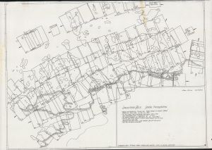
| Notes | The map shows the coverage of frames of the aerial photography flown by Peter Keage and Kurt Stuwe from a helicopter on 31 January 1987. |
| Keywords | Linhof , Keage , Stuwe |
Downloads
This is a hard copy map that has been scanned. See information about obtaining copies of hard copy maps.
Map Lists
No maps lists available.
Additional Information
Preview