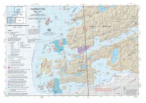
Map 14593: Vestfold Hills : Map 4 of 5
Map details
| Map Number | 14593 |
| Title | Vestfold Hills : Map 4 of 5 |
| Edition | 8 (Out of Date) |
| Previous edition | [Previous edition : 7] |
| Next Edition | [Next Edition : 9] |
| Scale | 1 : 50 000 |
| Publication date | August 2017 |
| Publisher |
Australian Antarctic Division (Australia)
|
| Spatial coverage |
( 77.7000° -68.5556°)
,
( 78.2000° -68.5556°)
,
( 78.2000° -68.6694°)
( 77.7000° -68.6694°) |
| Projection | Universal Transverse Mercator |
| Physical size | 29.7 x 42 cm A3 |
| Notes |
© Commonwealth of Australia 2017 . |
| Keywords | Broad Peninsula , Mule Peninsula , Donskiye Islands , Crooked Fjord , Adamson Bay , Ellis Fjord , ASPA 143 , ASPA 167 , Topographic |
Downloads
This is a digital map available for downloading.
Map Lists
This map belongs to the following lists. Use the link on the list to see all maps belonging to that list
Additional Information
| Horizontal datum | WGS 84 |
| Vertical datum | Mean sea level |
| Vertical unit | Metres |
| Nomenclature | Australian Antarctic Gazetteer |
Preview