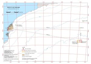
Map 14627: Davis to Mt Brown AAS 4414 Sites 2017-18
Map details
| Map Number | 14627 |
| Title | Davis to Mt Brown AAS 4414 Sites 2017-18 |
| Edition | 1 |
| Scale | 1 : 1 000 000 |
| Publication date | November 2017 |
| Publisher |
Australian Antarctic Division (Australia)
|
| Spatial coverage |
( 77.4550° -67.5740°)
,
( 87.0000° -67.5740°)
,
( 87.0000° -70.0050°)
( 77.4550° -70.0050°) |
| Projection | Lambert Conformal Conic |
| Physical size | 29.7 x 42 cm |
| Notes | This map shows locations relating to the 2017-18 field season for Australian Antarctic Science Project 4414. |
| Keywords | - |
Downloads
This is a digital map available for downloading.
Map Lists
No maps lists available.
Additional Information
| Horizontal datum | WGS84 |
| Vertical datum | Mean Sea Level |
| Vertical unit | Metres |
Preview